

Price and ratings
- Price
- CA$24.99
- Rating
- —
- Ratings
- 0France
Versions
- Released
- 30 May 201214 years ago
- Last update
- 4 months agoVersion 16.5.10
- Requires
- iOS 18.0 or later
Details
- Size
- 112.1 MB
- Languages
- 25
MARINE NAVIGATION — Offline GPS Chartplotter You Own Forever Tired of apps renting your maps every year? Worried about your secret fishing spots being tracked or sold? It’s time to take back control. Marine Navigation is the GPS chartplotter you buy once and own for life. No hidden fees, no forced subscriptions. Since 2009, sailors, fishermen, and sea lovers have trusted us for reliable, offline navigation that respects their privacy. CHOOSE YOUR WAY TO NAVIGATE - Try Free: Download Marine…
Competitors
Full chartTop of Paid · Navigation in Brazil. Marine Navigation is #46 there. Changes are over 7 days.
- #1 (number one)Change unknown
 Alpin Quest PRO – Outdoor GPSmustafa pistofoglu
 - #2Change unknown
- #3Change unknown
 Blitzer.de PROEifrig Media
 - #4Change unknown
 Caelum NavWeatherEliane Bergamaschi
 - #5Change unknown
 GPX Viewer PRO: Hike & BikeVectura Games
 - #6Change unknown
 TheodoliteCraig Hunter
 - #7New entry
 Alpin Quest PRO: Outdoor GPSDogukan ERDAGI
 - #8Change unknown
 Speedometer 55 Pro. GPS kit.Stanislav Dvoychenko
 - #9Change unknown
 Solocator - GPS Field CameraCivi Corp
 - #10Change unknown
 ZTL Italie - Zone à circulation limitéeGianluigi Ruggeri
 - #11New entry
 PureTrack GPS TrackerTim Bromhead
 - #12Change unknown
 Cruzerojorge espinoza
 - #13Change unknown
 Altitude DrivePeter Santangeli
 - #14Change unknown
 Topo Maps & Trails OfflineIvan Blajic
 - #15Change unknown
- #16Change unknown
 MilGPS PROmustafa pistofoglu
 - #17Change unknown
 Speed Tracker. ProOxagile LLC
 - #18Change unknown
- #19Change unknown
 GPS Kit - Offline GPS TrackerGarafa, LLC
 - #20Change unknown
 GPSVoid Stop Pty Ltd


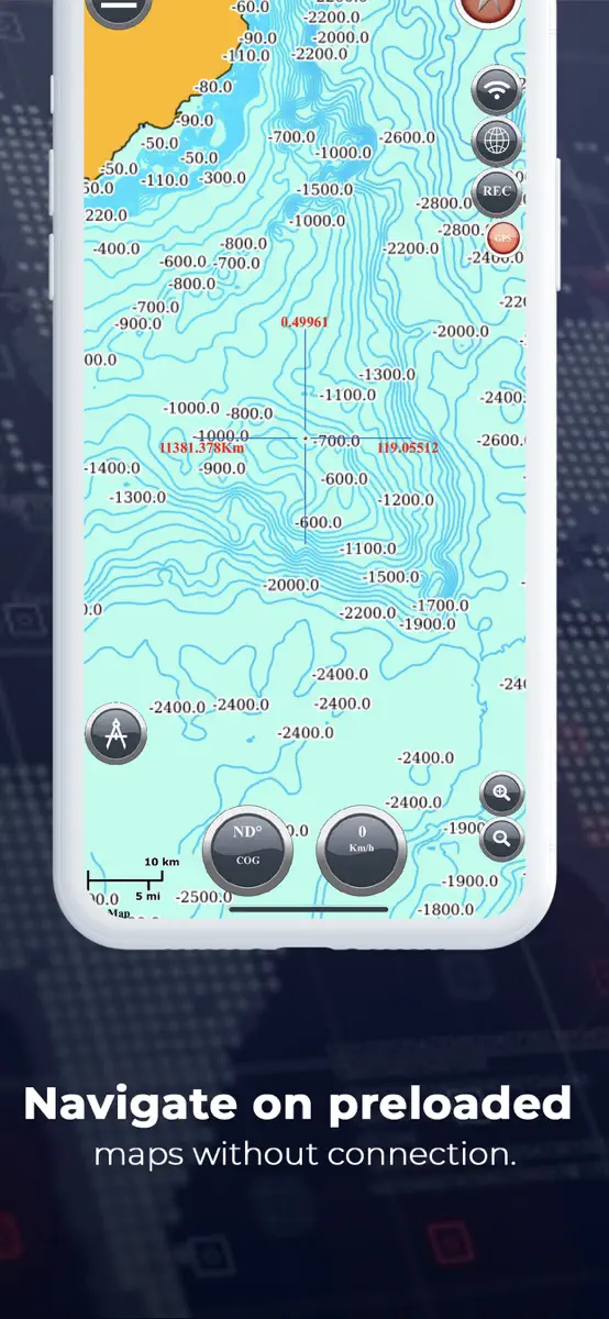
Store listing
How the app presents itself on the App Store. Select a screenshot to open it full size.




What's new
Version 16.5.10 · 11 May 2026 · 4 months ago
INTRODUCING: THE S57/ENC PRO ENGINE This changes everything. We built our own S57/ENC rendering engine from the ground up. This isn’t a licensed feature; it’s core technology crafted for one reason: to give you the fastest, most detailed, and most impossibly responsive professional chart experience on any mobile device. Import official S57 charts and navigate with precision that was once unthinkable. (PRO Version) YOUR KNOWLEDGE, MAPPED: CUSTOM MAP IMPORT The feature you’ve been waiting for. Turn any image into a fully navigable, offline chart. Scan a nautical chart, import a satellite image of a wreck, or even use a hand-drawn map of a secret spot. Your personal knowledge, finally on your chartplotter. Full Version: Get started by importing your first custom map. PRO Version: Unleash the full potential with unlimited, high-resolution custom maps. NEW — THE ANGLER'S SMART LOGBOOK Stop just "marking spots." Our new Advanced Waypoints turn your chart into an intelligent fishing log. Go beyond a simple pin: tag any location with the exact bait that worked, the type of fishing (trolling, jigging), catch details, and crucial conditions. It’s no longer just a waypoint—it’s your personal database for repeatable success on the water. REBUILT & REFINED: PRO-GRADE CORE TOOLS We’ve overhauled the essentials to give you total control. New Visual Offline Maps: A completely rebuilt, visual downloader. See exactly what you've downloaded on the map and manage storage with total, transparent control. Advanced Anchor Monitor: More than an alarm, it's your visual anchor watch. Set your anchor point, see the clear monitoring circle, and get instant drift alerts. It's peace of mind, visualized. NEW FOR PRO: OFFLINE TIDES & ALMANAC Two new professional tools for the serious navigator. Offline Tides (PRO): Get hyper-accurate tidal forecasts for any point on the map, far from any internet connection. Powered by the high-precision FES2022b model for serious planning. Sun & Moon Almanac: Master celestial awareness. An interactive Sun Dial shows the 24-hour sun arc (including critical twilight phases) and a Moon Altitude Chart plots its entire path. Perfect for planning night passages and predicting light. This update is our commitment made real: to provide independent navigators with the most powerful, private, and flexible tools on the water. Update now and take command of your navigation.
Current rankings
Every chart this app is in right now, best position first.
| Chart | Rank | 24 h | 7 days | Best | Days on chart |
|---|---|---|---|---|---|
| Brazil· Paid · Navigation | #46 | Down 1 place | Change unknown | #45 | 3 |
| France· Paid · Navigation | #83 | No change | Change unknown | #83 | 3 |
| Canada· Paid · Navigation | #85 | No change | Change unknown | #85 | 3 |
| Australia· Paid · Navigation | #91 | Down 8 places | Change unknown | #83 | 3 |
Rank history
Higher on the chart is better: #1 is at the top.
Sign in to see 30 days, 90 days and all history.
Brazil · Paid · Navigation: best #45, latest #46, over 4 snapshots since 8 Oct. No snapshots from 8 Oct to 9 Oct and on 9 Oct; the line joins the snapshots on either side.
Ranking events
Entries, big moves, #1s and new versions we've recorded.
No events recorded yet
Events appear as the app enters charts, moves 25+ places or ships a new version.