

As of 10 Nov 2026, MGRS GPS Kartierer is #9 in Paid · Navigation in France, its best of 2 chart positions across 2 countries. Appulse Index first saw MGRS GPS Kartierer in a tracked chart on 8 Oct 2026. Since then it has charted on 12 days in 3 countries, with a best rank of #8 in Paid · Navigation in France on 11 Oct 2026.
Current rank
#9France · Paid · Navigation
- Was
- —7 days ago
- Change
- Not enough history yetover 7 days
- Best
- #9in 7 days
- Longest chart run
- 9 daysFrance · Paid · Navigation
- New ratings, 7 days
- —Needs a week of rating history
Chart record
Every tracked chart, country and day since Appulse Index first saw this app in a chart.
What's new
Version 1.10 · 1 month ago
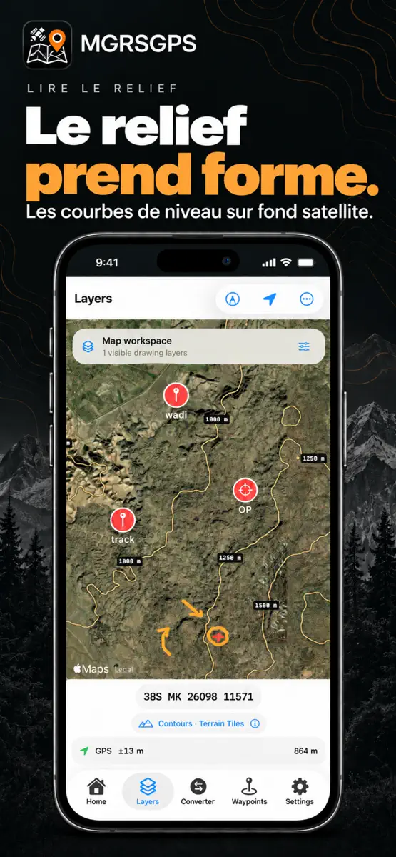
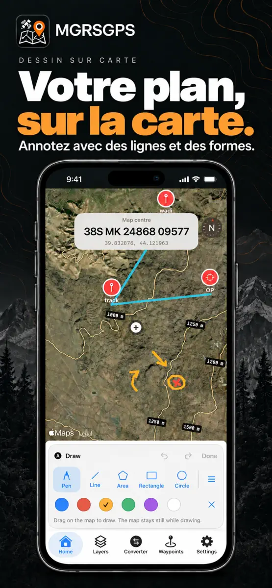
Votre carte devient un espace de travail. Découvrez les nouveautés de MGRSGPS 1.10 : • Dessinez sur les cartes des écrans Accueil et Calques : tracés à main levée, lignes, zones, rectangles et cercles. • Organisez vos dessins dans des calques nommés et réglez leur visibilité et leur opacité. • Affichez les courbes de niveau sur les cartes satellite, hybrides ou standard. • Masquez des points individuels ou des groupes entiers sur les deux cartes, sans les supprimer. • Partagez vos calques de dessin aux formats KML et JSON MGRSGPS. Importez des calques JSON MGRSGPS pour continuer à les modifier. • Consultez les coordonnées MGRS et la latitude/longitude ensemble sur l’écran d’accueil.
Ranking events
- Entered the Paid · Navigation chart at #9France
- Entered the Paid · Navigation chart at #30Germany
- Entered the Paid · Navigation chart at #11France
- Entered the Paid · Navigation chart at #25United Kingdom
- Entered the Paid · Navigation chart at #8France
About
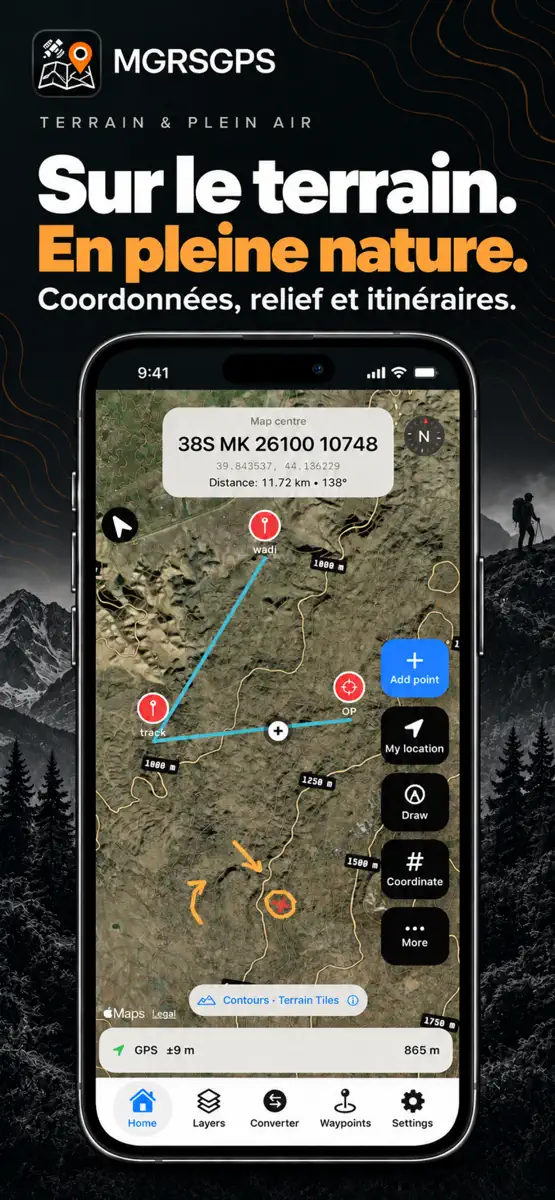
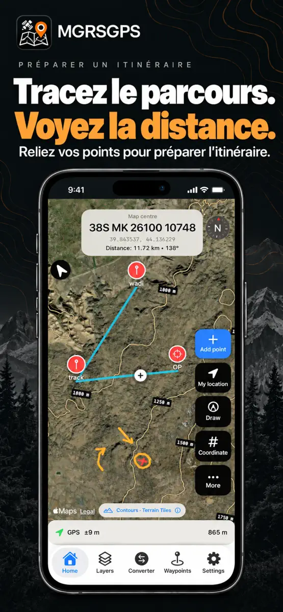
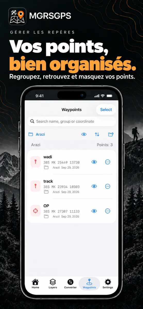
MGRS GPS Cartographe est une application de cartographie de terrain pratique, conçue pour les usages en extérieur, la navigation par coordonnées, la sécurité et les besoins professionnels sur le terrain. Travaillez avec les formats MGRS, UTM et Latitude/Longitude, enregistrez des points, créez des itinéraires et mesurez les distances dans une interface claire et rapide. Que ce soit pour planifier sur le terrain, gérer des points enregistrés ou convertir des coordonnées rapidement…
Ranks come from Apple's public App Store charts, checked once a day. Appulse Index isn't affiliated with Apple.
Rank history
Higher on the chart is better: #1 is at the top.
Sign in to see 30 days, 90 days and all history.
France · Paid · Navigation: best #9, latest #9, over 7 snapshots since 4 Nov.
In 2 charts now
| Chart | Rank | 24 h | 7 days | Best | Days on chart |
|---|---|---|---|---|---|
| France· Paid · Navigation · best #8 · 9 days | #9 | New entry | Not enough history yet | #8 | 9 |
| Germany· Paid · Navigation · best #30 · 1 day | #30 | New entry | Not enough history yet | #30 | 1 |
Competitors
Compare with the top 3Full chartTop of Paid · Navigation in France. MGRS GPS Kartierer is #9 there. Changes are over 7 days.
- #1 (number one)Up 1 place
 Blitzer.de PROEifrig Media
- #2Down 1 place
 Alpin Quest PRO – Outdoor GPSmustafa pistofoglu
- #3Up 22 places
 GPX Viewer PRO: Hike & BikeVectura Games
- #4Down 1 place
 MapOutValnova
- #5Not enough history yet
 Calmino — navigation GPXMakkr.
- #6New entry
 Pro Night — Night Vision AppViktor Pobedria
- #7New entry
 CoNavVladyslav Yarmak
- #8New entry
 WilhelmSKScott Bender
- #10New entry
 Yol+ | Radar Road AlertsBurak Tahtacioglu
- #11Down 6 places
- #12Not enough history yet
 Altitude DrivePeter Santangeli
- #13Up 22 places
 iLocation+: Here!Jeonghwan Kim
- #14Down 2 places
 Cimetière du Père Lachaise : carte interactiveChaviro Software
- #15Not enough history yet
 Instruments de bateauxFB Imray Laurie Norie & Wilson GmbH
- #16Not enough history yet
 Bristol Tour Map of BanksyStephen Kempin
- #17Not enough history yet
 NMEAremotezapfware
- #18Not enough history yet
 AlmicantaratPierre-Louis Deschamps
- #19Not enough history yet
 TerraGrid: GPS militaire MGRSEnes Furkan Bayram
- #20Not enough history yet
 Great Circle MapThe NFC Mint LLC
- #21Down 11 places
 Höhenmesser & PräzisionStudio Nano Ship, Inc.

Screenshots

As of 10 Nov 2026, MGRS GPS Kartierer is #9 in Paid · Navigation in France, its best of 2 chart positions across 2 countries. Appulse Index first saw MGRS GPS Kartierer in a tracked chart on 8 Oct 2026. Since then it has charted on 12 days in 3 countries, with a best rank of #8 in Paid · Navigation in France on 11 Oct 2026.
Store listing
How the app presents itself on the App Store. Select a screenshot to open it full size.
App facts
What Apple publishes about this app. Ratings are from one country's App Store.
- Price
- €9.99
- Rating
- 3.0 / 5 stars1 rating France
- Released
- 3 Nov 2025
- Last update
- Version 1.10
- Requires
- iOS 18.5or later
- Size
- 6.8 MB
- Languages
- 8
Chart record
Every tracked chart, country and day since Appulse Index first saw this app in a chart.
Rank history
Higher on the chart is better: #1 is at the top.
Sign in to see 30 days, 90 days and all history.
France · Paid · Navigation: best #9, latest #9, over 7 snapshots since 4 Nov.
Current rankings
Every chart this app is in right now, best position first.
| Chart | Rank | 24 h | 7 days | Best | Days on chart |
|---|---|---|---|---|---|
| France· Paid · Navigation · best #8 · 9 days | #9 | New entry | Not enough history yet | #8 | 9 |
| Germany· Paid · Navigation · best #30 · 1 day | #30 | New entry | Not enough history yet | #30 | 1 |
Ranking events
Entries, big moves, #1s and new versions we've recorded, by day.
- Entered the Paid · Navigation chart at #9France
- Entered the Paid · Navigation chart at #30Germany
- Entered the Paid · Navigation chart at #11France
- Entered the Paid · Navigation chart at #25United Kingdom
- Entered the Paid · Navigation chart at #8France
Competitors
Compare with the top 3Full chartTop of Paid · Navigation in France. MGRS GPS Kartierer is #9 there. Changes are over 7 days.
- #1 (number one)Up 1 placeBlitzer.de PROEifrig Media
- #2Down 1 placeAlpin Quest PRO – Outdoor GPSmustafa pistofoglu
- #3Up 22 placesGPX Viewer PRO: Hike & BikeVectura Games
- #4Down 1 placeMapOutValnova
- #5Not enough history yetCalmino — navigation GPXMakkr.
- #6New entryPro Night — Night Vision AppViktor Pobedria
- #7New entryCoNavVladyslav Yarmak
- #8New entryWilhelmSKScott Bender
- #9New entry
 MGRS GPS KartiererThis app
- #10New entryYol+ | Radar Road AlertsBurak Tahtacioglu
- #11Down 6 places
- #12Not enough history yetAltitude DrivePeter Santangeli
- #13Up 22 placesiLocation+: Here!Jeonghwan Kim
- #14Down 2 placesCimetière du Père Lachaise : carte interactiveChaviro Software
- #15Not enough history yetInstruments de bateauxFB Imray Laurie Norie & Wilson GmbH
- #16Not enough history yetBristol Tour Map of BanksyStephen Kempin
- #17Not enough history yetNMEAremotezapfware
- #18Not enough history yetAlmicantaratPierre-Louis Deschamps
- #19Not enough history yetTerraGrid: GPS militaire MGRSEnes Furkan Bayram
- #20Not enough history yetGreat Circle MapThe NFC Mint LLC
- #21Down 11 placesHöhenmesser & PräzisionStudio Nano Ship, Inc.
About
From the app's App Store listing.
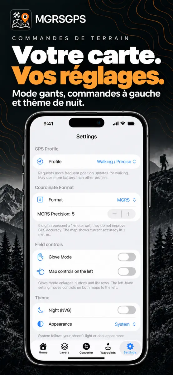
MGRS GPS Cartographe est une application de cartographie de terrain pratique, conçue pour les usages en extérieur, la navigation par coordonnées, la sécurité et les besoins professionnels sur le terrain.
Travaillez avec les formats MGRS, UTM et Latitude/Longitude, enregistrez des points, créez des itinéraires et mesurez les distances dans une interface claire et rapide. Que ce soit pour planifier sur le terrain, gérer des points enregistrés ou convertir des coordonnées rapidement…
What's new
Version 1.10 · 30 Sep 2026 ·
Votre carte devient un espace de travail. Découvrez les nouveautés de MGRSGPS 1.10 :
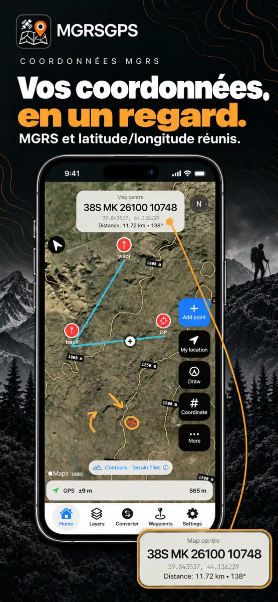
- Dessinez sur les cartes des écrans Accueil et Calques : tracés à main levée, lignes, zones, rectangles et cercles.
- Organisez vos dessins dans des calques nommés et réglez leur visibilité et leur opacité.
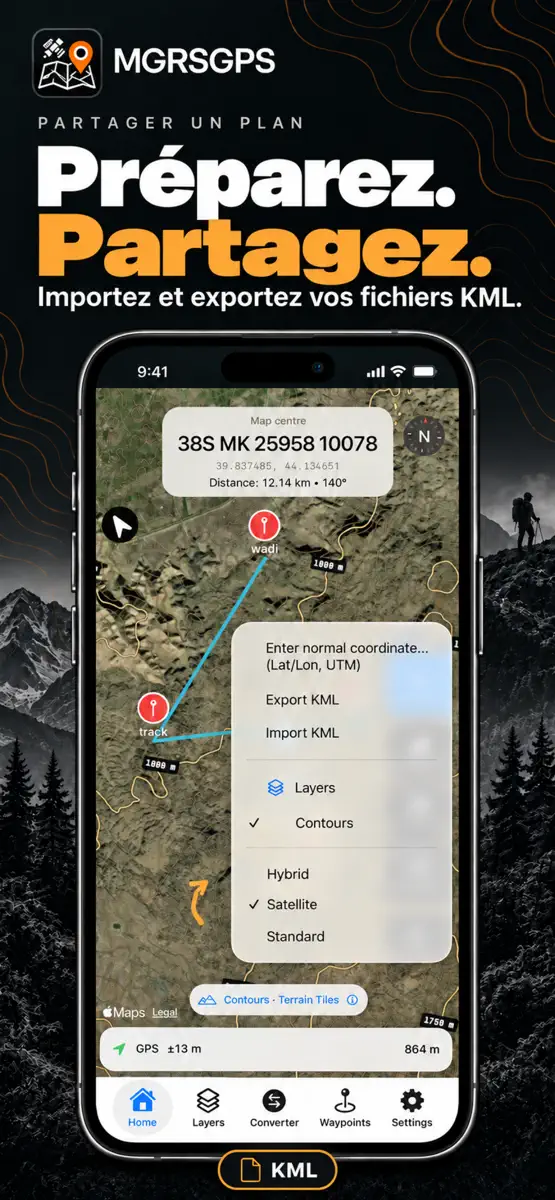
- Affichez les courbes de niveau sur les cartes satellite, hybrides ou standard.
- Masquez des points individuels ou des groupes entiers sur les deux cartes, sans les supprimer.
- Partagez vos calques de dessin aux formats KML et JSON MGRSGPS. Importez des calques JSON MGRSGPS pour continuer à les modifier.
- Consultez les coordonnées MGRS et la latitude/longitude ensemble sur l’écran d’accueil.
Ranks come from Apple's public App Store charts, checked once a day. Appulse Index isn't affiliated with Apple.