

Price and ratings
- Price
- $2.99
- Rating
- 2.9 out of 5
- Ratings
- 120United States
Versions
- Released
- 16 May 201412 years ago
- Last update
- 2 months agoVersion 3.0
- Requires
- iOS 26.0 or later
Details
- Size
- 25.6 MB
- Languages
- 7
Turn your iPhone or iPad into a practical field toolkit for camera measurement, maps, waypoints, compass work, and astronomical planning. RangeFinder brings the instruments you need into one focused app. Estimate a distance, inspect an angle, save a waypoint, measure a shape on the map, or plan around sunlight without breaking your workflow. CAMERA INSTRUMENTS • Estimate distance or height from an object of known size. • Measure distance with LiDAR on compatible devices. • Read heading…
Competitors
Full chartTop of Paid · Navigation in United States. Range Finder Tool is #13 there. Changes are over 7 days.
- #1 (number one)Change unknown
 MilGPSCascode Labs Pty Ltd
 - #2Change unknown
 Solocator - GPS Field CameraCivi Corp
 - #3Change unknown
- #4Change unknown
 Land Nav AssistantGammon Applications, LLC
 - #5Change unknown
 Sporty's E6B Flight ComputerSporty's Pilot Shop
 - #6Change unknown
 Blitzer.de PROEifrig Media
 - #7Change unknown
 Speedometer 55 Pro. GPS kit.Stanislav Dvoychenko
 - #8Change unknown
 TheodoliteCraig Hunter
 - #9Change unknown
 Find93Paul Kragthorpe
 - #10Change unknown
 LeadNav GPSLeadNav Systems LLC
 - #11Change unknown
 TACNAV-X: Military NavigationTacNav Systems LLC
 - #12Change unknown
 Holding Pattern TrainerFLEMINGER MEDIA LLC
 - #14Change unknown
 iLocation+: Here!Jeonghwan Kim
 - #15Change unknown
 aprs.fiGainIO
 - #16Change unknown
 Exit Strategy NYC Subway MapJWeg Ventures LLC
 - #17Change unknown
 ETA - GPS & maps driving timesEastwood
 - #18Change unknown
 C&O Canal ExplorerC&O Canal Trust
 - #19Change unknown
 Pro Altimeter - Barometric+GPSCraig Hunter
 - #20Change unknown
 MapOutValnova
 - #21Change unknown
 Pinbox - Map Your WorldSeasonal Spring

Store listing
How the app presents itself on the App Store. Select a screenshot to open it full size.
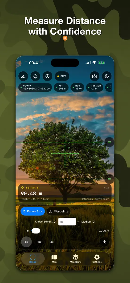
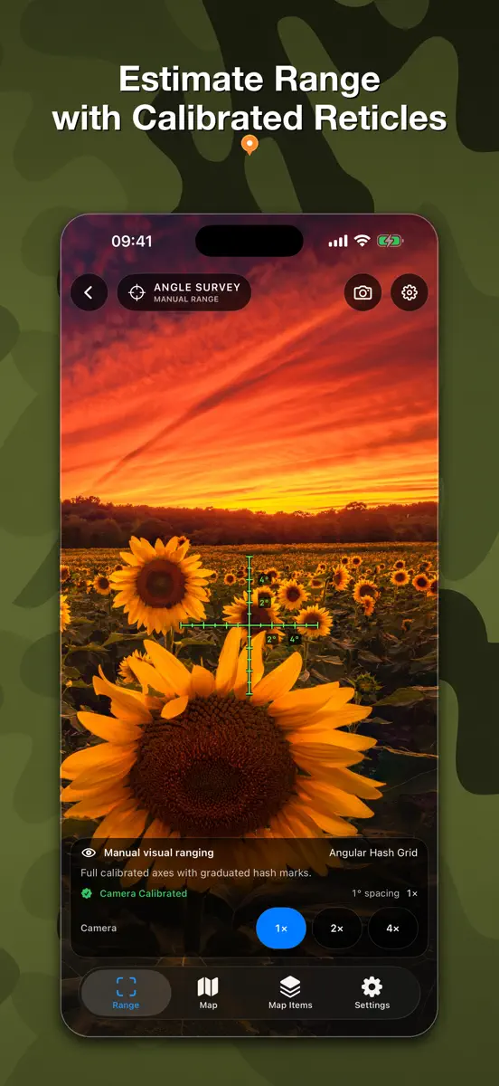
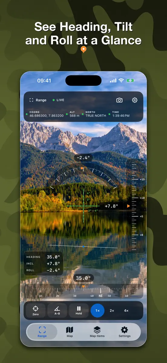
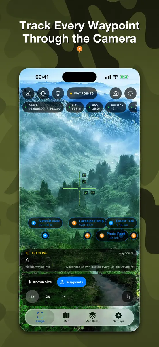
What's new
Version 3.0 · 4 Aug 2026 · 2 months ago
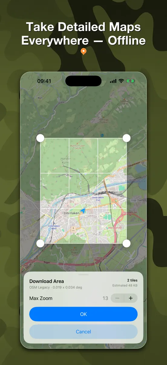
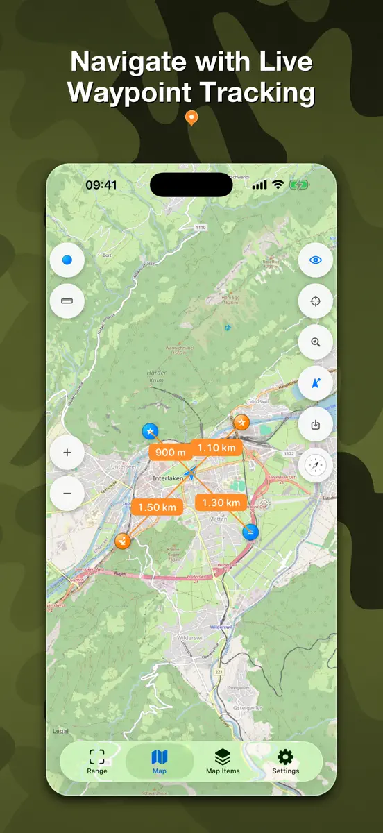
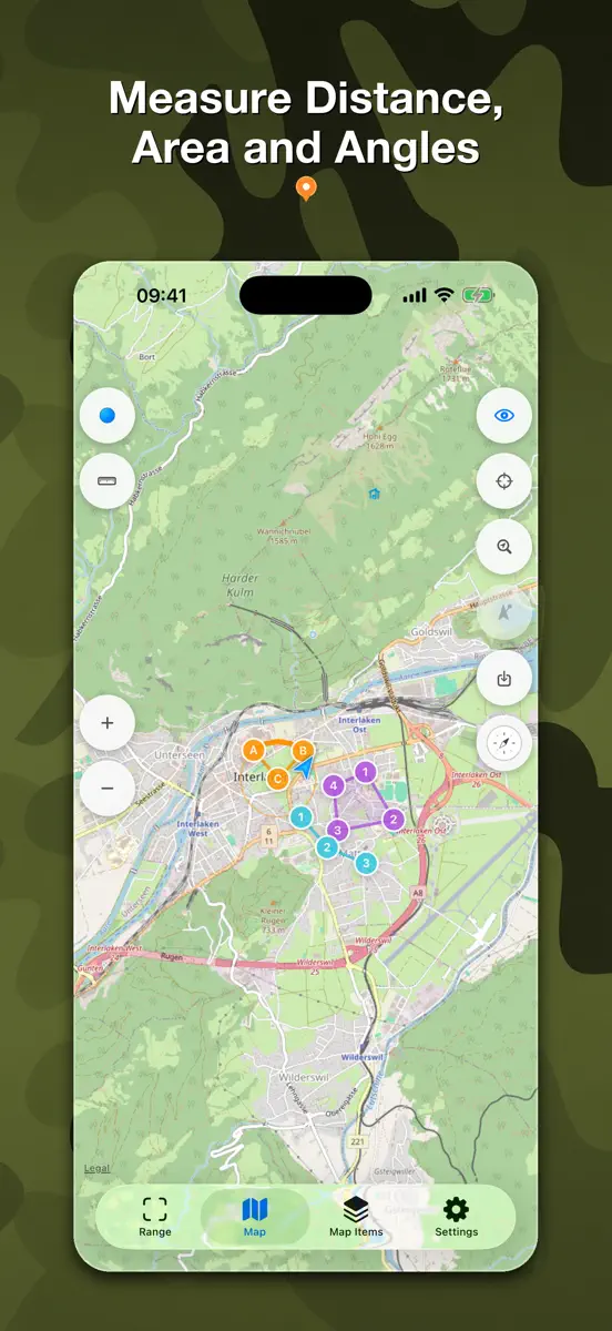
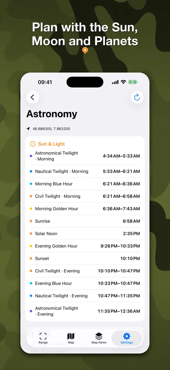
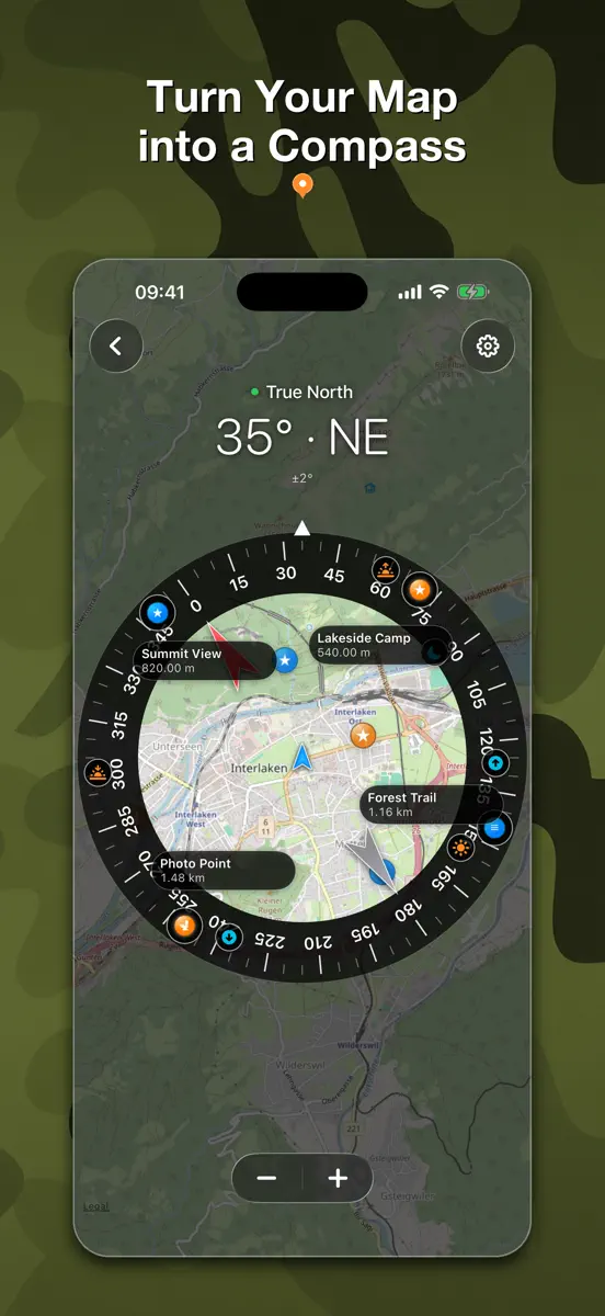
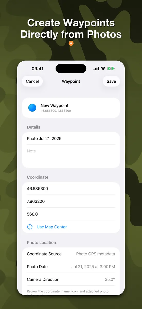
RangeFinder 3.0 is a major new release, rebuilt as a modern field toolkit. • Meet the new Range, Angle, and Angle Survey instruments with shared camera, reticle, capture, and sensor settings. • Use a calibrated vector-reticle library with Fine Cross as the default. Save your first instrument photo to unlock six bonus reticles. • Explore raster and OSM vector maps, download supported offline areas, manage storage, and zoom vector maps up to level 19. • Create waypoints from a photo’s GPS metadata, attach photos and voice messages, and track selected waypoints on the map, compass, and live camera. • Measure distances, angles, shapes, and areas on the map, with improved coordinate search and inspection. • Plan outdoors with compass tools and on-device Sun, Moon, planet, twilight, golden-hour, and blue-hour calculations. • Bring compatible waypoints, media, and settings forward safely from the previous app. This update also includes extensive performance, accessibility, localization, camera-capture, and offline-map improvements.
Current rankings
Every chart this app is in right now, best position first.
| Chart | Rank | 24 h | 7 days | Best | Days on chart |
|---|---|---|---|---|---|
| United States· Paid · Navigation | #13 | Change unknown | Change unknown | #13 | 2 |
Rank history
Higher on the chart is better: #1 is at the top.
Sign in to see 30 days, 90 days and all history.
United States · Paid · Navigation: best #13, latest #13, over 2 snapshots since 8 Oct. No snapshots from 8 Oct to 9 Oct; the line joins the snapshots on either side.
Ranking events
Entries, big moves, #1s and new versions we've recorded.
- Climbed #49 → #13 in Paid · NavigationUnited States