

As of 2 Nov 2026, MapLab Survey - 土地測量とGIS is #70 in Grossing · Navigation in Japan, the one tracked chart it's in. Its best rank in the last 7 days was #23 in Grossing · Navigation in Mexico.
Current rank
#70Japan · Grossing · Navigation
- Was
- —7 days ago
- Change
- Not enough history yetover 7 days
- Best
- #70in 7 days
- Longest chart run
- 1 dayJapan · Grossing · Navigation
- New ratings, 7 days
- —Needs a week of rating history
What's new
Version 3.0.0 · 2 months ago
La mayor actualización de la app hasta ahora. NUEVO: VISOR CAD • Abre DXF, Netcad NCZ, KML/KMZ, GeoJSON, shapefile-ZIP y LandXML • Nombres y colores de capa reales, tramas y etiquetas de texto • Ajuste a extremo, punto medio y arista; acimut, escala y retícula • Dibuja encima y envía al mapa solo lo que quieras NUEVO: PLANOS ESCANEADOS Y HOJAS • Coloca hojas JPG, PNG y PDF sobre el mapa • Georreferenciación automática desde world-file y .prj • GeoPDF: las coordenadas del archivo se leen, sin encaje manual • Encaje con puntos de apoyo y detección de errores groseros • Recorte, alineación arrastrando y enderezado de escaneos torcidos NUEVO: ESTACIÓN TOTAL, GNSS/RTK Y NIVELACIÓN • Lectura de Leica GSI, Carlson RW5, Sokkia SDR33, Nikon RAW y LandXML • Receptores GNSS/RTK externos, NTRIP, calibración y registro NMEA • El trazo ya usa el fix del receptor externo • Nivelación: error de cierre, control de tolerancia y compensación EL SISTEMA DE TU PAÍS • La app se abre con el sistema oficial de tu país — 148 países • Coordenadas en el sistema elegido: mapa, atributos y sello en las fotos • Al cambiar de huso, te sigue el huso correcto del mismo sistema • Búsqueda por nombre de país y selector de país en el panel • Aviso si el sistema elegido no cubre donde estás MÁS NOVEDADES • Importación de paquetes de teselas MBTiles • Cuadrícula UTM/MGRS sobre el mapa • Importación y exportación GPX • Hasta 4 fotos por elemento • El modo rápido ya funciona con líneas y polígonos • Organización de capas en carpetas y grupos anidados • Informes de campo con nombre, logotipo, firma y código QR • Mapas sin conexión: descargar, listar y borrar • Compatibilidad con formato horizontal y tabletas • Formularios de campo y toda la interfaz en 46 idiomas CORRECCIONES • Resuelto el bloqueo del mapa • Cambiar de archivo en el visor CAD ya no te devuelve al mapa • Se pide confirmación antes de descartar los dibujos • La distancia no se actualizaba durante el trazo — corregido • Muchas correcciones de errores y mejoras de rendimiento
Ranking events
- Entered the Grossing · Navigation chart at #70Japan
- Dropped #45 → #87 in Grossing · NavigationMexico
- Entered the Grossing · Navigation chart at #10Mexico
- Entered the Grossing · Navigation chart at #98Brazil
- Entered the Grossing · Navigation chart at #49India
About
MapLab Survey es una app de SIG de campo y topografía: dibuja, mide, convierte coordenadas, abre archivos CAD y exporta a DXF — con conexión o sin ella. FUNCIONA EN TU PAÍS DESDE EL PRIMER MOMENTO La app se abre con el sistema de coordenadas oficial y el idioma de tu país. 148 países, 46 idiomas. Si cambias de huso, te sigue el huso correcto del mismo sistema, sin configurar nada. DIBUJA Y MIDE CON GPS • Puntos, líneas y polígonos • Superficie, perímetro, distancia, coordenadas, pendiente y
Ranks come from Apple's public App Store charts, checked once a day. Appulse Index isn't affiliated with Apple.
Rank history
Higher on the chart is better: #1 is at the top.
Sign in to see 30 days, 90 days and all history.
Japan · Grossing · Navigation: best #70, latest #70, over 7 snapshots since 27 Oct.
In 1 chart now
| Chart | Rank | 24 h | 7 days | Best | Days on chart |
|---|---|---|---|---|---|
| Japan· Grossing · Navigation · best #70 · 1 day | #70 | New entry | Not enough history yet | #70 | 1 |
Competitors
Full chartTop of Grossing · Navigation in Japan. MapLab Survey - 土地測量とGIS is #70 there. Changes are over 7 days.
- #1 (number one)Up 1 place
 トラックカーナビ by NAVITIME ナビタイムNAVITIME JAPAN CO.,LTD.
- #2Down 1 place
 NAVITIME(地図と乗換の総合ナビ)NAVITIME JAPAN CO.,LTD.
- #3No change
 カーナビタイム - CarPlay対応カーナビNAVITIME JAPAN CO.,LTD.
- #4No change
 乗換NAVITIME(電車乗り換え・バス乗り換え・時刻表)NAVITIME JAPAN CO.,LTD.
- #5Up 1 place
 ツーリングサポーター 原付バイク〜大型バイクまで使えるナビNAVITIME JAPAN CO.,LTD.
- #6Down 1 place
 ドライブサポーター by NAVITIME (カーナビ)NAVITIME JAPAN CO.,LTD.
- #7No change
 Yahoo!カーナビYahoo Japan Corporation
- #8No change
 ゼンリン地図ナビ 住宅地図/カーナビ/地図アプリ/トラックZENRIN DataCom CO.,LTD.
- #9No change
 バスNAVITIME 時刻表&乗り換え案内&路線図ナビNAVITIME JAPAN CO.,LTD.
- #10Up 1 place
 配達NAVITIME ゼンリン住宅地図/荷物管理/カーナビNAVITIME JAPAN CO.,LTD.
- #11Down 1 place
 乗換案内Jorudan Co.,Ltd.
- #12No change
 Yahoo!乗換案内Yahoo Japan Corporation
- #13Up 3 places
 自転車NAVITIME-サイクリングナビと速度計測・マップNAVITIME JAPAN CO.,LTD.
- #14Down 1 place
 渋滞情報マップbyNAVITIME 渋滞・通行止め・高速料金NAVITIME JAPAN CO.,LTD.
- #15No change
 new pec smart株式会社マップル・オン
- #16Down 2 places
 ATIS交通情報(アティス)~リアルタイム渋滞情報Nihon Enterprise Co.,Ltd.
- #17No change
 バスカーナビ by ナビタイム - 大型バスの交通規制を考慮NAVITIME JAPAN CO.,LTD.
- #18Up 4 places
 auナビウォークKDDI CORPORATION
- #19Up 1 place
 auカーナビ Powered by NAVITIMEKDDI CORPORATION
- #20Up 5 places
 メル友-運命の出会い大人の友達作りは地図でサードプレイス共有Naoki Watanabe
Screenshots


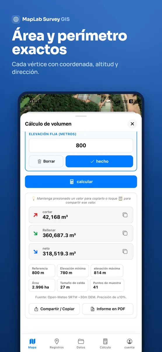


As of 2 Nov 2026, MapLab Survey - 土地測量とGIS is #70 in Grossing · Navigation in Japan, the one tracked chart it's in. Its best rank in the last 7 days was #23 in Grossing · Navigation in Mexico.
Store listing
How the app presents itself on the App Store. Select a screenshot to open it full size.
App facts
What Apple publishes about this app. Ratings are from one country's App Store.
- Price
- Free
- Released
- 14 Apr 2026
- Last update
- Version 3.0.0
- Requires
- iOS 15.1or later
- Size
- 92.5 MB
- Languages
- 45
Rank history
Higher on the chart is better: #1 is at the top.
Sign in to see 30 days, 90 days and all history.
Japan · Grossing · Navigation: best #70, latest #70, over 7 snapshots since 27 Oct.
Current rankings
Every chart this app is in right now, best position first.
| Chart | Rank | 24 h | 7 days | Best | Days on chart |
|---|---|---|---|---|---|
| Japan· Grossing · Navigation · best #70 · 1 day | #70 | New entry | Not enough history yet | #70 | 1 |
Ranking events
Entries, big moves, #1s and new versions we've recorded, by day.
- Entered the Grossing · Navigation chart at #70Japan
- Dropped #45 → #87 in Grossing · NavigationMexico
- Entered the Grossing · Navigation chart at #10Mexico
- Entered the Grossing · Navigation chart at #98Brazil
- Entered the Grossing · Navigation chart at #49India
Competitors
Full chartTop of Grossing · Navigation in Japan. MapLab Survey - 土地測量とGIS is #70 there. Changes are over 7 days.
- #1 (number one)Up 1 placeトラックカーナビ by NAVITIME ナビタイムNAVITIME JAPAN CO.,LTD.
- #2Down 1 placeNAVITIME(地図と乗換の総合ナビ)NAVITIME JAPAN CO.,LTD.
- #3No changeカーナビタイム - CarPlay対応カーナビNAVITIME JAPAN CO.,LTD.
- #4No change乗換NAVITIME(電車乗り換え・バス乗り換え・時刻表)NAVITIME JAPAN CO.,LTD.
- #5Up 1 placeツーリングサポーター 原付バイク〜大型バイクまで使えるナビNAVITIME JAPAN CO.,LTD.
- #6Down 1 placeドライブサポーター by NAVITIME (カーナビ)NAVITIME JAPAN CO.,LTD.
- #7No changeYahoo!カーナビYahoo Japan Corporation
- #8No changeゼンリン地図ナビ 住宅地図/カーナビ/地図アプリ/トラックZENRIN DataCom CO.,LTD.
- #9No changeバスNAVITIME 時刻表&乗り換え案内&路線図ナビNAVITIME JAPAN CO.,LTD.
- #10Up 1 place配達NAVITIME ゼンリン住宅地図/荷物管理/カーナビNAVITIME JAPAN CO.,LTD.
- #11Down 1 place乗換案内Jorudan Co.,Ltd.
- #12No changeYahoo!乗換案内Yahoo Japan Corporation
- #13Up 3 places自転車NAVITIME-サイクリングナビと速度計測・マップNAVITIME JAPAN CO.,LTD.
- #14Down 1 place渋滞情報マップbyNAVITIME 渋滞・通行止め・高速料金NAVITIME JAPAN CO.,LTD.
- #15No changenew pec smart株式会社マップル・オン
- #16Down 2 placesATIS交通情報(アティス)~リアルタイム渋滞情報Nihon Enterprise Co.,Ltd.
- #17No changeバスカーナビ by ナビタイム - 大型バスの交通規制を考慮NAVITIME JAPAN CO.,LTD.
- #18Up 4 placesauナビウォークKDDI CORPORATION
- #19Up 1 placeauカーナビ Powered by NAVITIMEKDDI CORPORATION
- #20Up 5 placesメル友-運命の出会い大人の友達作りは地図でサードプレイス共有Naoki Watanabe
- #70New entryMapLab Survey - 土地測量とGISThis app
About
From the app's App Store listing.
MapLab Survey es una app de SIG de campo y topografía: dibuja, mide, convierte coordenadas, abre archivos CAD y exporta a DXF — con conexión o sin ella.
FUNCIONA EN TU PAÍS DESDE EL PRIMER MOMENTO
La app se abre con el sistema de coordenadas oficial y el idioma de tu país. 148 países, 46 idiomas. Si cambias de huso, te sigue el huso correcto del mismo sistema, sin configurar nada.
DIBUJA Y MIDE CON GPS
- Puntos, líneas y polígonos
- Superficie, perímetro, distancia, coordenadas, pendiente y
What's new
Version 3.0.0 · 18 Aug 2026 ·
La mayor actualización de la app hasta ahora.
NUEVO: VISOR CAD
- Abre DXF, Netcad NCZ, KML/KMZ, GeoJSON, shapefile-ZIP y LandXML
- Nombres y colores de capa reales, tramas y etiquetas de texto
- Ajuste a extremo, punto medio y arista; acimut, escala y retícula
- Dibuja encima y envía al mapa solo lo que quieras
NUEVO: PLANOS ESCANEADOS Y HOJAS
- Coloca hojas JPG, PNG y PDF sobre el mapa
- Georreferenciación automática desde world-file y .prj
- GeoPDF: las coordenadas del archivo se leen, sin encaje manual
- Encaje con puntos de apoyo y detección de errores groseros
- Recorte, alineación arrastrando y enderezado de escaneos torcidos
NUEVO: ESTACIÓN TOTAL, GNSS/RTK Y NIVELACIÓN
- Lectura de Leica GSI, Carlson RW5, Sokkia SDR33, Nikon RAW y LandXML
- Receptores GNSS/RTK externos, NTRIP, calibración y registro NMEA
- El trazo ya usa el fix del receptor externo
- Nivelación: error de cierre, control de tolerancia y compensación
EL SISTEMA DE TU PAÍS
- La app se abre con el sistema oficial de tu país — 148 países
- Coordenadas en el sistema elegido: mapa, atributos y sello en las fotos
- Al cambiar de huso, te sigue el huso correcto del mismo sistema
- Búsqueda por nombre de país y selector de país en el panel
- Aviso si el sistema elegido no cubre donde estás
MÁS NOVEDADES
- Importación de paquetes de teselas MBTiles
- Cuadrícula UTM/MGRS sobre el mapa
- Importación y exportación GPX
- Hasta 4 fotos por elemento
- El modo rápido ya funciona con líneas y polígonos
- Organización de capas en carpetas y grupos anidados
- Informes de campo con nombre, logotipo, firma y código QR
- Mapas sin conexión: descargar, listar y borrar
- Compatibilidad con formato horizontal y tabletas
- Formularios de campo y toda la interfaz en 46 idiomas
CORRECCIONES
- Resuelto el bloqueo del mapa
- Cambiar de archivo en el visor CAD ya no te devuelve al mapa
- Se pide confirmación antes de descartar los dibujos
- La distancia no se actualizaba durante el trazo — corregido
- Muchas correcciones de errores y mejoras de rendimiento
Ranks come from Apple's public App Store charts, checked once a day. Appulse Index isn't affiliated with Apple.