

As of 10 Nov 2026, FieldNav: MGRS & UTM GPS is #21 in Paid · Navigation in Canada, its best of 2 chart positions across 2 countries. Its best rank in the last 7 days was #6 in Paid · Navigation in India. Appulse Index first saw FieldNav: MGRS & UTM GPS in a tracked chart on 16 Oct 2026. Since then it has charted on 15 days in 4 countries, with a best rank of #6 in Paid · Navigation in India on 5 Nov 2026.
Current rank
#21Canada · Paid · Navigation
- Was
- —7 days ago
- Change
- Not enough history yetover 7 days
- Best
- #21in 7 days
- Longest chart run
- 6 daysFrance · Paid · Navigation
- New ratings, 7 days
- —Needs a week of rating history
Chart record
Every tracked chart, country and day since Appulse Index first saw this app in a chart.
What's new
Version 1.0.3 · 3 months ago
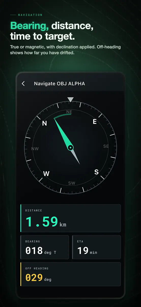
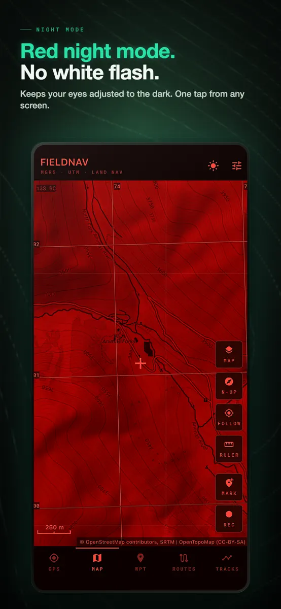
A new look across the app: bigger readouts, quieter framing, and tiles that fill the screen. Navigating no longer depends on a working compass. When the phone has no magnetometer, or it is confused, the rose follows your course over the ground and says so on screen. Bearing, distance and time to target keep working while you walk. Recorded tracks have their own tab now. You can rename one, delete it, and the point count comes from the saved track instead of whatever was still on screen. Fixes for anyone working south of the equator: UTM and MGRS readouts read back correctly, and grid lines are drawn on the ellipsoid of the datum you picked, including the Norway and Svalbard exceptions. Altitude on iOS was corrected twice against the geoid. Now once. A point you mark on the map shows no altitude at all instead of a made-up zero. If a track point cannot be saved, recording stops and tells you, instead of quietly losing the trace. Night mode is complete: the offline maps screen, the map scale bar and the menus stay red, so nothing flashes white in the dark. Waypoint altitude is editable, and you can export a single point or a whole group as GPX.
Ranking events
- Entered the Paid · Navigation chart at #21Canada
- Dropped #7 → #76 in Paid · NavigationIndia
- Entered the Paid · Navigation chart at #12France
- Entered the Grossing · Navigation chart at #61India
- Entered the Paid · Navigation chart at #6India
- Entered the Paid · Navigation chart at #21Canada
Show 2 earlier events
- Entered the Paid · Navigation chart at #29Australia
- Entered the Paid · Navigation chart at #8France
About
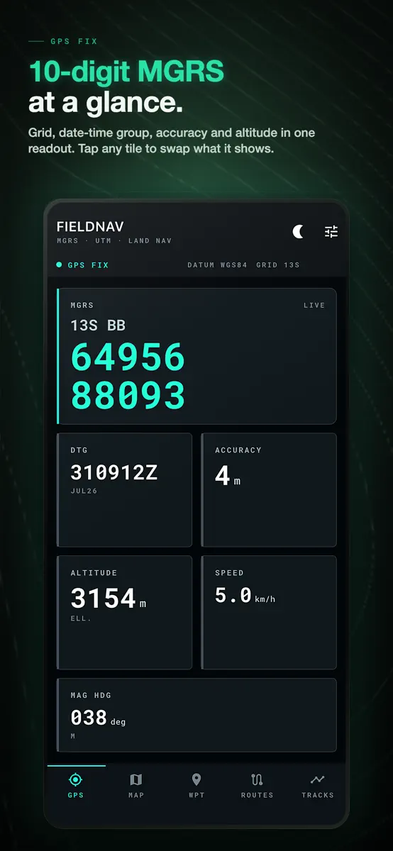
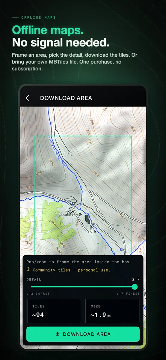
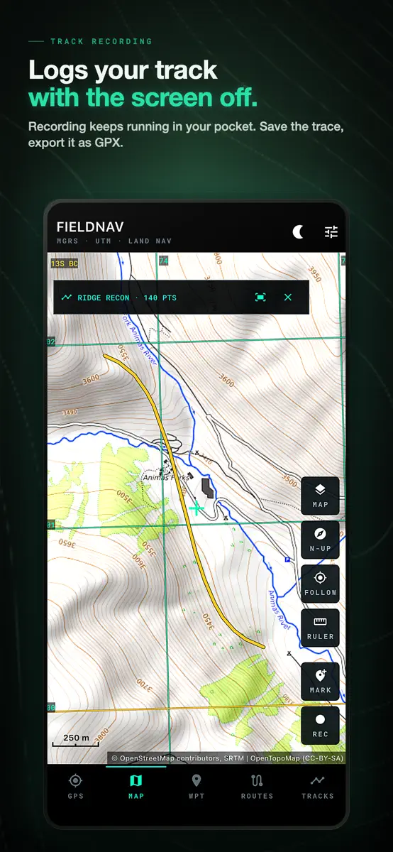
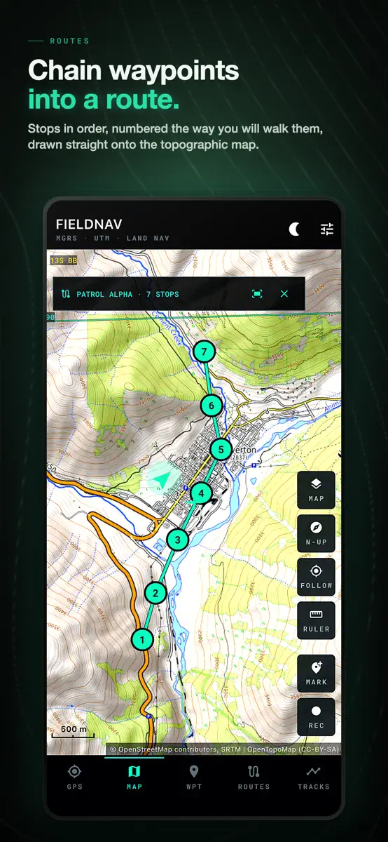
Know your exact grid position, save it, and find your way back — even with no signal, no account, and no subscription. FieldNav is an offline MGRS and UTM GPS for land navigation beyond cell coverage. Read military grid (MGRS) and UTM coordinates, follow a compass with true magnetic declination, drop and find waypoints, build routes, and record tracks. Core navigation and your imported offline maps work with no signal. Built for people who navigate off the pavement: • Search & rescue, ground…
Ranks come from Apple's public App Store charts, checked once a day. Appulse Index isn't affiliated with Apple.
Rank history
Higher on the chart is better: #1 is at the top.
Sign in to see 30 days, 90 days and all history.
Canada · Paid · Navigation: best #21, latest #21, over 7 snapshots since 4 Nov.
In 2 charts now
| Chart | Rank | 24 h | 7 days | Best | Days on chart |
|---|---|---|---|---|---|
| Canada· Paid · Navigation · best #21 · 4 days | #21 | New entry | Not enough history yet | #21 | 4 |
| France· Paid · Navigation · best #10 · 6 days | #27 | Down 6 places | Not enough history yet | #10 | 6 |
Competitors
Compare with the top 3Full chartTop of Paid · Navigation in Canada. FieldNav: MGRS & UTM GPS is #21 there. Changes are over 7 days.
- #1 (number one)No change
 Solocator - GPS Field CameraCivi Corp
- #2Up 8 places
 NZ Topo50 South IslandRight Place Resources
- #3Up 3 places
 TheodoliteCraig Hunter
- #4Up 36 places
 SnowTrailsNLBryan Taylor
- #5Up 3 places
 British Columbia Road CamerasS. Technologies Solutions
- #6New entry
 CycleLineStefan Schwinghammer
- #7Up 30 places
 GPS Kit - Offline GPS TrackerGarafa, LLC
- #8Up 12 places
 Speedometer 55 Pro. GPS kit.Stanislav Dvoychenko
- #9Up 26 places
 Blitzer.de PROEifrig Media
- #10Up 11 places
- #11Down 4 places
 GOToronto: GO Transit SidekicktripleQuad Software
- #12New entry
 SKHighway LocatorSean Buchko
- #13Up 53 places
 Light Pollution MapJurij Stare
- #14Up 17 places
 Sporty's E6B Flight ComputerSporty's Pilot Shop
- #15Up 18 places
 BLM Public Lands Map Guide USAGeoPOI LLC
- #16Up 79 places
 Real Tides & Currents Chart HDFlytomap
- #17Not enough history yet
 Marine Vessel Nav LightsEdmund Broadbent
- #18New entry
 GPS AveragingMichael Andreas May
- #19New entry
 Anchor SentryMichael Dieter Konz
- #20New entry
 Cruzerojorge espinoza

Screenshots
More from PAWEŁ KANDYBOWICZ
| App | Best rank now | Released | App Store |
|---|---|---|---|
 Angelbuch Schonzeit MindestmaßSports · | Not charting |

As of 10 Nov 2026, FieldNav: MGRS & UTM GPS is #21 in Paid · Navigation in Canada, its best of 2 chart positions across 2 countries. Its best rank in the last 7 days was #6 in Paid · Navigation in India. Appulse Index first saw FieldNav: MGRS & UTM GPS in a tracked chart on 16 Oct 2026. Since then it has charted on 15 days in 4 countries, with a best rank of #6 in Paid · Navigation in India on 5 Nov 2026.
Store listing
How the app presents itself on the App Store. Select a screenshot to open it full size.
App facts
What Apple publishes about this app. Ratings are from one country's App Store.
- Price
- CA$3.99
- Released
- 24 Jun 2026
- Last update
- Version 1.0.3
- Requires
- iOS 13.0or later
- Size
- 29.7 MB
- Languages
- 1
Chart record
Every tracked chart, country and day since Appulse Index first saw this app in a chart.
Rank history
Higher on the chart is better: #1 is at the top.
Sign in to see 30 days, 90 days and all history.
Canada · Paid · Navigation: best #21, latest #21, over 7 snapshots since 4 Nov.
Current rankings
Every chart this app is in right now, best position first.
| Chart | Rank | 24 h | 7 days | Best | Days on chart |
|---|---|---|---|---|---|
| Canada· Paid · Navigation · best #21 · 4 days | #21 | New entry | Not enough history yet | #21 | 4 |
| France· Paid · Navigation · best #10 · 6 days | #27 | Down 6 places | Not enough history yet | #10 | 6 |
Ranking events
Entries, big moves, #1s and new versions we've recorded, by day.
- Entered the Paid · Navigation chart at #21Canada
- Dropped #7 → #76 in Paid · NavigationIndia
- Entered the Paid · Navigation chart at #12France
- Entered the Grossing · Navigation chart at #61India
- Entered the Paid · Navigation chart at #6India
- Entered the Paid · Navigation chart at #21Canada
- Entered the Paid · Navigation chart at #29Australia
- Entered the Paid · Navigation chart at #8France
Competitors
Compare with the top 3Full chartTop of Paid · Navigation in Canada. FieldNav: MGRS & UTM GPS is #21 there. Changes are over 7 days.
- #1 (number one)No changeSolocator - GPS Field CameraCivi Corp
- #2Up 8 placesNZ Topo50 South IslandRight Place Resources
- #3Up 3 placesTheodoliteCraig Hunter
- #4Up 36 placesSnowTrailsNLBryan Taylor
- #5Up 3 placesBritish Columbia Road CamerasS. Technologies Solutions
- #6New entryCycleLineStefan Schwinghammer
- #7Up 30 placesGPS Kit - Offline GPS TrackerGarafa, LLC
- #8Up 12 placesSpeedometer 55 Pro. GPS kit.Stanislav Dvoychenko
- #9Up 26 placesBlitzer.de PROEifrig Media
- #10Up 11 places
- #11Down 4 placesGOToronto: GO Transit SidekicktripleQuad Software
- #12New entrySKHighway LocatorSean Buchko
- #13Up 53 placesLight Pollution MapJurij Stare
- #14Up 17 placesSporty's E6B Flight ComputerSporty's Pilot Shop
- #15Up 18 placesBLM Public Lands Map Guide USAGeoPOI LLC
- #16Up 79 placesReal Tides & Currents Chart HDFlytomap
- #17Not enough history yetMarine Vessel Nav LightsEdmund Broadbent
- #18New entryGPS AveragingMichael Andreas May
- #19New entryAnchor SentryMichael Dieter Konz
- #20New entryCruzerojorge espinoza
- #21New entry
 FieldNav: MGRS & UTM GPSThis app
About
From the app's App Store listing.
Know your exact grid position, save it, and find your way back — even with no signal, no account, and no subscription.
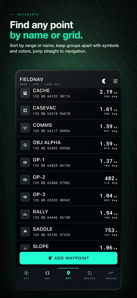
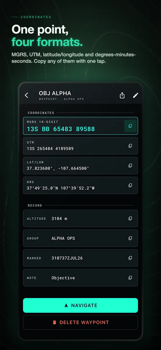
FieldNav is an offline MGRS and UTM GPS for land navigation beyond cell coverage. Read military grid (MGRS) and UTM coordinates, follow a compass with true magnetic declination, drop and find waypoints, build routes, and record tracks. Core navigation and your imported offline maps work with no signal.
Built for people who navigate off the pavement:
- Search & rescue, ground…
What's new
Version 1.0.3 · 1 Aug 2026 ·
A new look across the app: bigger readouts, quieter framing, and tiles that fill the screen.
Navigating no longer depends on a working compass. When the phone has no magnetometer, or it is confused, the rose follows your course over the ground and says so on screen. Bearing, distance and time to target keep working while you walk.
Recorded tracks have their own tab now. You can rename one, delete it, and the point count comes from the saved track instead of whatever was still on screen.
Fixes for anyone working south of the equator: UTM and MGRS readouts read back correctly, and grid lines are drawn on the ellipsoid of the datum you picked, including the Norway and Svalbard exceptions.
Altitude on iOS was corrected twice against the geoid. Now once. A point you mark on the map shows no altitude at all instead of a made-up zero.
If a track point cannot be saved, recording stops and tells you, instead of quietly losing the trace.
Night mode is complete: the offline maps screen, the map scale bar and the menus stay red, so nothing flashes white in the dark.
Waypoint altitude is editable, and you can export a single point or a whole group as GPX.
More from PAWEŁ KANDYBOWICZ
Their other apps that Appulse has seen in the charts, charting ones first.
| App | Best rank now | Released | App Store |
|---|---|---|---|
Angelbuch Schonzeit MindestmaßSports · | Not charting |
Ranks come from Apple's public App Store charts, checked once a day. Appulse Index isn't affiliated with Apple.